| |
|
| |
|

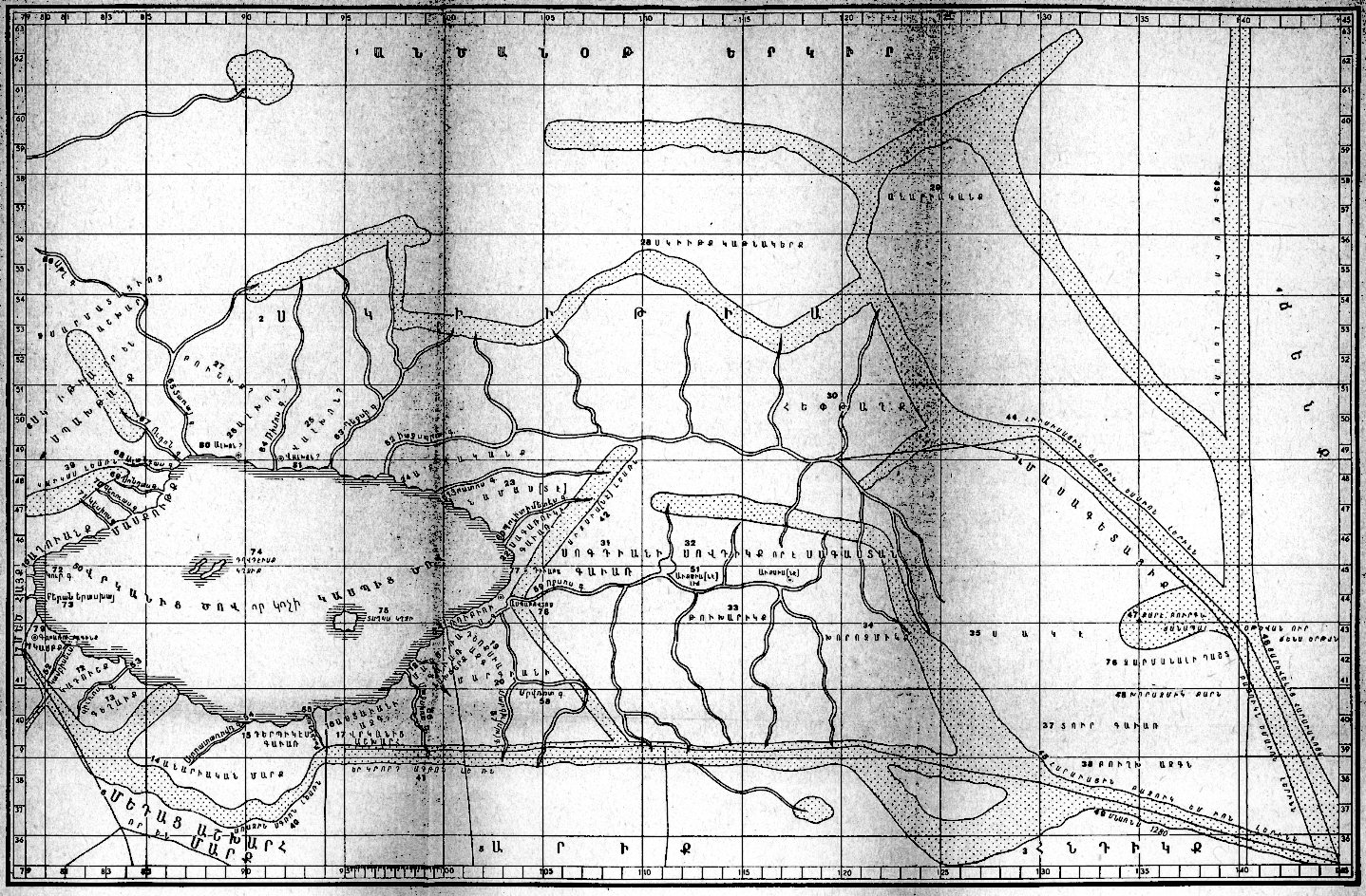
Rivers:
52 - Kambisevs; 53 - Kir; 54 - Stratarovd; 55 - Harindas;
56 - Maksira; 57 - Margiv (Mrv);
58 - Mrvrot; 59 - Oxos; 60 - Politimet; 61 - Jostos;
62 - Jaxart; 63 - Dexi;
64 - Rimmos; 65 - Tara (ra); 66 - Atl; 67 - Udon;
68 - Alontas; 69 - Sondas;
70 - Geruas; 71 - Kesios; 72 - Kura; 73 - mouth of
Erash (Arax)
Settlements:
77 - Divaba; 78 - Aspabovtos; 79 - Gabaru bagink (
; 80 - Alhon?; 81 - Valhon?
47 - a stone tower, a road and a port, from where one sets of for the country of Sini (China)
The original scanned map of S. Eremjan
(0.5 Mb)
The map in CorelDraw! format (zipped)
[Back]